ARCHAEOLOGICAL SURVEY OF THE RUINS OF BAD SCHWANBERG
By olah
13. January 2023
Project number: 2.3201 (Knowledge building project)
Involved cooperation partners:
FH JOANNEUM | University of Applied Sciences
AIRlabs Austria
Project Description/Methods:
The overall objective of this project is to investigate how UAS can support archaeological excavations in a meaningful way. What sensors are needed to detect structures – some of which are buried in the ground – with “off-the-shelf” drones? The concrete research object for this project is the identification of support potential for archaeological prospection via “off-the-shelf” UAS. Generally, these are easy to operate by users and are equipped with sensors that are of high quality, but not specialised for the specific application. Ideally, the results should provide information about structures hidden in the soil. However, the findings should also reveal possible deficits or gaps for the minimum criterion of usable results.
Results/Dissemination:
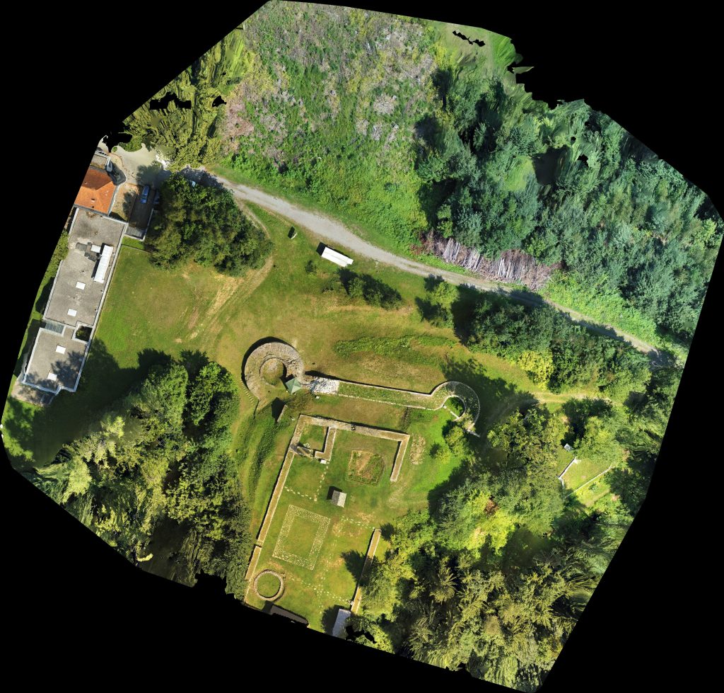
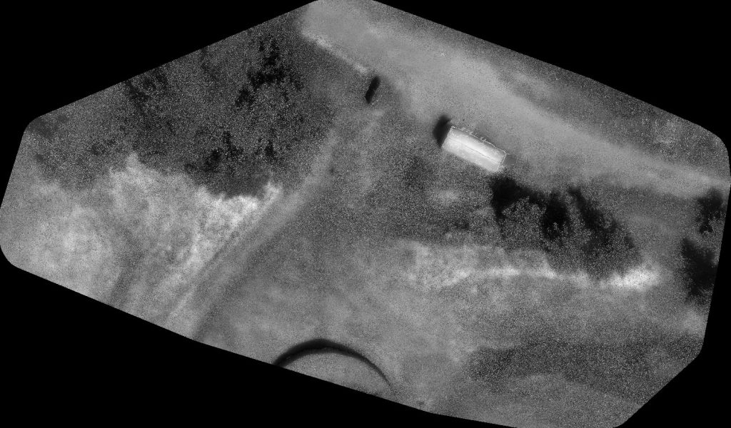
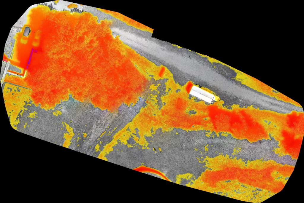
The results show that the taking of orthophotos (both optical and multispectral) was low-threshold and provided valid results for illustration and survey purposes, but did not meet archaeological requirements. The dense vegetation around the castle complex does not allow for further analysis in an archaeological context using the methods mentioned. With purely optical methods, the numerous trees and bushes prevent a view of possible structures or features on the ground surface that could provide clues. The multispectral analyses were also distorted by the existing vegetation, as only its infrared signature (leaves, bushes, grasses etc. heated by sunlight) could be recorded instead of that of the ground. In order to record only relevant temperature ranges (=temperature of the structures to be found in the soil), other ranges were masked out by adjusting the presets. However, due to a lack of empirical experience, it is uncertain whether “correct” temperature ranges were excluded or whether the measurements were unusable due to incorrect settings in this respect.
For future projects of this kind, the use of alternative sensor technology is recommended. Lidar methods are promising here in order to penetrate the soil sufficiently and illustrate hidden structures – independently of sunlight, temperature differences, and vegetation on the ground. The use of multispectral methods is nevertheless worth testing. For this purpose, however, the environment must be such that the area covered is as free of vegetation as possible so that no extraneous infrared signatures are detected. Furthermore, there is a need for empirical experience regarding the temperature ranges to be imaged in order to be able to specifically capture those temperatures and thus the infrared signatures of the structures hidden in the ground, and to be able to correctly mask out extraneous influences.